Thursday, April 30, 2015

Mt Mansfield and other VT highpointing adventures

Kim and I were just about to get ready to graduate college and become real adults so we  planned a few weekend trips to get away and experience life while we still had the time.  We had been dating for about three years at this point and were starting to get pretty serious.  I was just about to leave to start training for my life in the Army, and Kim was getting ready to start full time on Pharmacy school.  A lot was about to change for us and this trip was one of our last carefree, college kids trying to be grownups trips. 

We decided to head to Vermont for the weekend to Climb Mt Mansfield, along the way there were a ton of different things to do so we of course stopped a few times along the way.  We didn't want to stay at a hotel and we didn't have any of our camping gear at school so we instead decided to stay at a local Bed and Breakfast, which turned out to be a great idea.  This was the first time we had chosen to stay at a Bed and Breakfast and it was the start of a long line of weekend vacations at them for years
to come.  We love the idea of supporting local businesses, we also love that there is usually an interesting person who runs the place to talk to.  The thing we love the most though, is the breakfast.  Kim has an unusual love affair with breakfast so any time she gets to have a good homemade breakfast she is happy.  You know what they say, happy wife happy life, so therefore I love anywhere that serves breakfast.  It is really a win win.  The Gables Inn in Stowe is where we stayed and it is a convenient jumping off point for this state highpoint.  If you haven't tried staying at a local B&B you should really try one out on your next trip.

We left after class on a Friday and were up and ready to go early the next morning we chose to take the Long trail South and were not disappointed.  We only went to the Highpoint itself (the Chin) and didn't continue along the trail to the rest of the face profile. Mt Mansfield is commonly referred to by these terms, the picture below can show you a little clearer what they mean as the "face" isn't exactly easily recognizable.  The longs trail passes just to the left of the Adams apple on this picture and heads straight for the chin.  If you choose to do the whole Face it is a quick detour from the trail to the Adams Apple  then up to the Chin as I will talk about here and then it adds about another 2 miles above treeline to pick up the Nose and the Forehead.  This could be a really fun hike, but it just wasn't in the game plan for us this time.  Maybe in the future I will head back and pick up the rest of the mountain.

Forehead Nose Chin Adams Apple Mansfield Profile


Mount Mansfield Longs Trail Summit Marker Highpoint Vermont
Beginning of the steep section and first sight of snow
For us on our hike it was about 2.3 miles one way or about 4.6 miles of roundtrip hiking.   It was early in the season so the trail was still partially snow covered but still easy to hike with normal hiking boots. We started off from the Long Trail South Trailhead and meandered through some very well defined and easy elevation for quite some time.  It was still pretty warm so T-shirts were fine and there were already some wildflowers starting to blossom even though it was still only May. Though the views are not very scenic down low on the mountain there are a few bubbly brooks running near the trail and the trail itself is very well marked and maintained.  There is not much elevation gain for the first mile or so and after that the trail gets progressively steeper for much of the rest of the climb.  At about 1 mile in we also started to hit our first patches of snow on the trail.  This made the going a little slower but nothing that was too hard to handle, (although I wish I had brought my waterproof boots!). The trails climbs steadily from here to the Taft lodge where there is an outhouse and running water to refill if you need it.  We stopped briefly to eat some snacks and then kept heading up.  The Taft lodge is a pretty cool place if you want to spend the night though.  It sleeps up to 24.  There is a whole system of these lodges and other shelters and overnight sites along the Longs trail if you wanted to turn this into a multi night backpacking trip without carrying your own tent.  You can read more about that here. 


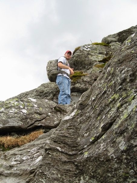
From the Lodge there is only about .3 miles of hiking left to go but this is where the trail starts to get really steep.  If you add in a little bit of snow and ice it can get a bit treacherous.  I wouldn't say that it is really dangerous but it is definitely a spot to slow down and make sure your footing is good or you may be in for a bad day.


Mount Mansfield Longs Trail Summit Marker Highpoint Vermont
Snow on the trail after Taft Lodge

Mount Mansfield Longs Trail Summit Marker Highpoint Vermont
Some rock Scrambling required near the top


Mount Mansfield Longs Trail Summit Marker Highpoint Vermont
Kim with the USGS Marker at the summit
 We made the top at just before noon and took a few pictures but with clouds in the sky and it threatening to rain on us we didn't stay for long and made our way back to the trailhead.  Some people chose to continue hiking along the ridge to the top of Stowe Mountain Ski resort and take the Gondola down, but to me that feels like cheating (it's also really expensive from what I hear)  so I preferred to hike my way down.  Kim and I's legs were starting to get tired about half of the way down and Kim actually took a tumble.  Note to self:  do not laugh at Kim when she falls, she will not be happy about it for quite a while.  O well, lesson learned I guess.  The rest of the descent was uneventful and we made our way back to the B&B for some well deserved hot tub time and then out to dinner to fill our bellies.


Vermont Highpoint longs trail
Standing at the Summit of Mt Mansfield as the storm clouds start to roll in
Of course the trip wasn't over yet, Kim and I still had one day left of our Vermont vacation.  On the way up to Stowe, we passed signs for the Ben and Jerry's factory.  Now if you have been living under a rock for the past 20 years you probably haven't heard of Ben and Jerry's but if not you know that it is probably the best Ice Cream ever made.  And really, who doesn't love ice cream.  Plus, we just climbed a mountain, we deserved a treat.  We dutifully stopped for some ice cream and took a tour.  It is absolutely worth the trip if you are in the area and a great thing to do if you you are climbing Mansfield.  I hope you enjoyed  If you have any questions or comments let me know!

Ben and Jerry's Factory Tour, Tour Bus, ice cream bus, Stowe Vermont things to do
Ben and Jerry's tour

Monday, April 20, 2015

Missouri Highpoint: Taum Sauk Mountain and other State Park Adventures

Another day, another highpointing trip in the books.  This time I brought along a good friend of mine J and his dog Juneau.  J is always dependable for an adventure and we decided to bag the Missouri highpoint but along the way also hit one of the state parks that I had been eyeing.  I had been living in Missouri for a number of years and over that time had gotten out to several of the state parks in the area and I was really impressed.  The state parks here are some of the best in the country from what I have seen. 

The plan was to head out to Johnson's Shut-Ins state park for some hiking and then to make our way up to Taum Sauk Mountain State Park to conquer the mighty state Highpoint for Missouri. This one is really a drive up but we chose to take a bit longer of a hike so that we could see more of the park and get to spend some more time hiking. 


Missouri State park Photos
On the trail at Johnson's Shut-Ins

We started off with a quick trip to Johnson's Shut-Ins state park which was incredibly cool.  The description from the park website is below and does a much better job of describing the water and rock formations than I could do.
The park is named after the "shut-ins" where the rushing waters of the East Fork of the Black River are "shut-in" by the hard volcanic rock. Over 1.4 billion years ago, violent volcanic eruptions created hard rhyolite bedrock forming the knobby shapes of the St. Francois Mountains. As the rhyolite cooled, it cracked in many places, creating pathways for flowing water. Over millions of years, water eroded the cracks into narrow channels. Scoured by water-born sand and gravel, the channels grew deeper and wider. The eroding action of water continues to shape these rocks into the potholes, the plunge pools below small waterfalls, and the chutes that form wild, natural waterslides that delight visitors today.
This part of the park is the main attraction that drives people here and it is absolutely worth the trip.  Kids and pets alike would have a blast swimming and playing in the pools created by the river surrounded by waterfalls and  adults would have a great time too.  Truly something for everyone.  I also found the hiking trails to be well maintained and user friendly.  I highly suggest taking a look at their website and taking a trip down there if you are in the area.  It is also literally attached to Taum Sauk Mountain State park so if you are looking for a side trip with the Taum Sauk Highpoint it is a great trip to take.

Juneau and I at the Summit
After leaving Johnson's Shut-Ins we made the trek over to Taum Sauk Mountain State Park to bag our Highpoint (really the reason for our trip).  We planned on heading to the highpoint and then taking the Mina Sauk Falls trail (3 mile loop) around the park. The highpoint itself is really accessible with just a short hike of less than a mile to the "top". The summit is almost indistinguishable from the surrounding area but it has a nice granite monument to the fact that it is a state highpoint.  We made our way to the top and took a few photos to document the fact that we had been there and then started the hike around the Falls Trail.  The hike was nice, and not necessarily scenic but  it gave us something else to do.  The one thing we were disappointed by was the fact that the Mina Sauk Falls were actually dry, as in no waterfall at all, it is advertised as the tallest falls in the state but apparently only holds that distinction after heavy rains or earlier in the spring so it you are planning a visit in the fall prepare for no water.  If I were to do it again I would forego this hike and spend more time at the nearby Johnsons Shut-Ins, or at the next park that we happened upon. 


After leaving Taum Sauk, while we were on our way home we saw a few signs for Elephant Rocks State Park.  After how impressed we were with some of the other state parks in the system we decided to check out this one as well and were just as impressed.  This park is small but it was really cool to see the rocks jutting out of nowhere.  It all seemed very out of place for in the middle of the Ozarks in Missouri.  In fact the type of granite that the "Elephants" are made out of is only found in two places in the world, the other being on Pikes Peak in the front range of Colorado.  (which I have also had the pleasure of visiting, you can read about that trip  here)  The park features a mile long trail that is designed for visually impaired people with Braille signposts dotted along the paved trail.  Those wanting to venture outside are also encouraged to head into the middle of the park and climb in/around the many Elephant boulders scattered around.  We were there nearing sunset and that added to the dramatic views of the rocks as the sun was setting around us. 
J and I exploring Elephant Rocks State Park
Overall, the Actual highpoint itself is not remarkable and in fact the Taum Sauk State Park isn't anything special but getting out there to visit some of the nearby parks is quite a trip and comes highly recommended.  Enjoy!

Saturday, April 11, 2015

Clingmans Dome and Great Smoky Mountains National Park

Time for the Molloy Family to once again hit the road as a move is in order.  This time, my Wife, who was finishing up her Doctorate in Pharmacy in Massachusetts, was finally moving out to live with me in Missouri.  It had been several years of living apart and we were eager to make the move and get back to living together like a "normal" couple.  As per usual we planned on stopping at various places along the trip to make it a little more interesting and to break up the monotony of driving.  One of the places on our list was Great Smoky Mountains National Park. 

We like to stay at bed and breakfasts whenever possible so we booked a room at the Eight Gables Inn and I can honestly say it was one of the nicest bed and breakfasts we have ever stayed in.  The rooms were comfortable, the food was excellent and the service was great.  I would highly recommend it to anyone looking for a place near the park.  We got in pretty late so we went to the Inn the night before and didn't really see around.  But the next morning we drove through Gatlinburg to get to the park and let me tell you that place is something.    If you have never been to Gatlinburg I don't think I even have the words to describe it.  It is like a tourist trap on steroids, definitely not what I would expect going to a national park.  It was really crazy, there were people everywhere, tons of shops, a Ripleys believe it or not museum, carnival rides, I mean really over the top.  We weren't interested in that so we drove through and spent the day in the park which is worlds apart from Gatlinburg.

The park itself is beautiful.  We didn't have a ton of time to spend there so we didn't do a lot of hiking, we mostly did the drive through tour of the major attractions but we did make sure to stop at Clingmans Dome.  We didn't even know that the TN state highpoint was in the park until I picked up the little brochure that they hand out at all of the National Parks.  Once I knew that it was there we made sure to add it to our list of things to do so I could add it to my list of completed Highpoints. We stopped at a number of scenic overlooks and I was surprised to see that the park does really live up to its name.  The fog that collects in between the mountains in the valleys does really look like smoke, it stayed foggy like that for the majority of the day and made for some really incredible pictures. 

       
Great Smoky Mountains Views
 
signpost appalachian trail mountains-to-sea trail clingmans dome
Trailhead to Clingman's dome
After a few stops at various places in the park it was finally time to summit Clingman's dome.  Normally for a highpoint like this I plan to take a bit of a different route than the standard easy route from the parking lot but for this one we were pressed for time and there were plenty of other things to see and do in the park so we opted for the standard route which is a half mile hike along a paved path.  The path was really nice with tons of wildflowers and a few butterflies floating along.  The weather was great too with plenty of visibility but still with that misty fog low in the valleys that make this such a cool place.  Kim and I meandered our way up the path, which was quite crowded but still pleasant and made our way to the observation tower.  The trail was especially nice if you were traveling with kids or somebody who needed a wheelchair as the entire trail (to include the tower itself) are all easily wheelchair and stroller accessible. The observation tower was really impressive and gave great views of the park. and a bonus was that we got to see a black bear climb it's way out of the brush and hang out directly below the tower for quite a while.  It had been a while since I had seen a bear in the wild so we spent some time watching as he played in the underbrush.  You can tell the bears must be really used to seeing a lot of people because even though there were at least 40-50 people within a few meters of him he payed us no mind and carried on with whatever it was he was doing.
 

smoky mountains wildflowers butterflies fog haze Clingman's dome summit tower monument observation tower

Feel free to leave any comments or suggestions for our next adventure! Enjoy.

Friday, April 10, 2015

Kanas' Highpoint, "Mount" Sunflower and other road trip adventures

Back in 2012 I began my move from Missouri to Colorado which inevitable led me through the most boring of all road trip states...Kansas.  Now, if you have never driven through Kansas don't feel left out.  It pretty much looks like this........
 
........For eight hours or so.  Honestly I don't think I saw anything else other than cornfields and oil rigs and not a hill to be seen.  However, this didn't deter me from trying to find something to break up the monotony.  I did a lot of research to try to find something, anything, that would be an interesting place to hike or a cool place to stop and to my surprise I actually found two. 
 
The first stop on the trip was Monument rocks, which is also known as Chalk Pyramids.  It wasn't far from my route on I-70 and from the pictures it looked really cool.  It is also listed as a National Natural Landmark, and, I have found that anytime something is listed as a National anything it is usually pretty good so I checked it out.  I was impressed, it isnt a big place but it is very accessible.  You essentially just drive right up to it, there weren't any frills, no admission, no visitor center, no park rangers, it was just the monument itself standing out there in the middle of nowhere undisturbed.  I was also the only person out there so I took my time and walked around for a while.  There wasn't a whole lot nearby so I didn't do any hiking but I spent a good amount of time admiring the beauty of nature.  It was incredible to see this collection of Chalk formations rising up out of the flatlands of Kansas.  Definitely worth the trip if you are driving through. 
 

Me at the Summit of Mount Sunflower
The second stop on this trip was another one of my Highpoints that I have been collecting.  I hadn't gotten the Kansas Highpoint so I figured as I was driving through I would add this one to my list making it my 7th State highpoint achieved.  I will admit I wasn't that excited about this was as it was a drive up and I had generally planned my highpoints to avoid the roads and attempt to actually "climb" them as much as I could but this one was unavoidable.  There was nothing to climb it was going to be a drive up.  It was made much more interesting by the fact that the owners of the land that the highpoint sits on have embraced the absurdity of hundreds of people flocking to this gentle rise in the middle of a field and did a great job on their highpoint monument.  It is actually my favorite so far.  There is a register and a book with a fun reading about the highpoint as well.  I took some pictures so you can see what they wrote.  Overall I was impressed by the time they took to make it a special highpoint and I think you will agree if you ever make it there.
The monument at Mt Sunflower
Sign at the cattle guard to Mt. Sunflower


One of the best register reads I have seen on a state highpoint!

I didn't expect to enjoy the stops that I made as I took this trip but I was pleasantly surprised by both.  I don't think that I would go out of my way for a visit to this part of the country but if you find yourself driving down I-70 and get sick of looking at corn they are both worthwhile stops.