Monday, April 20, 2015

Missouri Highpoint: Taum Sauk Mountain and other State Park Adventures

Another day, another highpointing trip in the books.  This time I brought along a good friend of mine J and his dog Juneau.  J is always dependable for an adventure and we decided to bag the Missouri highpoint but along the way also hit one of the state parks that I had been eyeing.  I had been living in Missouri for a number of years and over that time had gotten out to several of the state parks in the area and I was really impressed.  The state parks here are some of the best in the country from what I have seen. 

The plan was to head out to Johnson's Shut-Ins state park for some hiking and then to make our way up to Taum Sauk Mountain State Park to conquer the mighty state Highpoint for Missouri. This one is really a drive up but we chose to take a bit longer of a hike so that we could see more of the park and get to spend some more time hiking. 


Missouri State park Photos
On the trail at Johnson's Shut-Ins

We started off with a quick trip to Johnson's Shut-Ins state park which was incredibly cool.  The description from the park website is below and does a much better job of describing the water and rock formations than I could do.
The park is named after the "shut-ins" where the rushing waters of the East Fork of the Black River are "shut-in" by the hard volcanic rock. Over 1.4 billion years ago, violent volcanic eruptions created hard rhyolite bedrock forming the knobby shapes of the St. Francois Mountains. As the rhyolite cooled, it cracked in many places, creating pathways for flowing water. Over millions of years, water eroded the cracks into narrow channels. Scoured by water-born sand and gravel, the channels grew deeper and wider. The eroding action of water continues to shape these rocks into the potholes, the plunge pools below small waterfalls, and the chutes that form wild, natural waterslides that delight visitors today.
This part of the park is the main attraction that drives people here and it is absolutely worth the trip.  Kids and pets alike would have a blast swimming and playing in the pools created by the river surrounded by waterfalls and  adults would have a great time too.  Truly something for everyone.  I also found the hiking trails to be well maintained and user friendly.  I highly suggest taking a look at their website and taking a trip down there if you are in the area.  It is also literally attached to Taum Sauk Mountain State park so if you are looking for a side trip with the Taum Sauk Highpoint it is a great trip to take.

Juneau and I at the Summit
After leaving Johnson's Shut-Ins we made the trek over to Taum Sauk Mountain State Park to bag our Highpoint (really the reason for our trip).  We planned on heading to the highpoint and then taking the Mina Sauk Falls trail (3 mile loop) around the park. The highpoint itself is really accessible with just a short hike of less than a mile to the "top". The summit is almost indistinguishable from the surrounding area but it has a nice granite monument to the fact that it is a state highpoint.  We made our way to the top and took a few photos to document the fact that we had been there and then started the hike around the Falls Trail.  The hike was nice, and not necessarily scenic but  it gave us something else to do.  The one thing we were disappointed by was the fact that the Mina Sauk Falls were actually dry, as in no waterfall at all, it is advertised as the tallest falls in the state but apparently only holds that distinction after heavy rains or earlier in the spring so it you are planning a visit in the fall prepare for no water.  If I were to do it again I would forego this hike and spend more time at the nearby Johnsons Shut-Ins, or at the next park that we happened upon. 


After leaving Taum Sauk, while we were on our way home we saw a few signs for Elephant Rocks State Park.  After how impressed we were with some of the other state parks in the system we decided to check out this one as well and were just as impressed.  This park is small but it was really cool to see the rocks jutting out of nowhere.  It all seemed very out of place for in the middle of the Ozarks in Missouri.  In fact the type of granite that the "Elephants" are made out of is only found in two places in the world, the other being on Pikes Peak in the front range of Colorado.  (which I have also had the pleasure of visiting, you can read about that trip  here)  The park features a mile long trail that is designed for visually impaired people with Braille signposts dotted along the paved trail.  Those wanting to venture outside are also encouraged to head into the middle of the park and climb in/around the many Elephant boulders scattered around.  We were there nearing sunset and that added to the dramatic views of the rocks as the sun was setting around us. 
J and I exploring Elephant Rocks State Park
Overall, the Actual highpoint itself is not remarkable and in fact the Taum Sauk State Park isn't anything special but getting out there to visit some of the nearby parks is quite a trip and comes highly recommended.  Enjoy!

Saturday, April 11, 2015

Clingmans Dome and Great Smoky Mountains National Park

Time for the Molloy Family to once again hit the road as a move is in order.  This time, my Wife, who was finishing up her Doctorate in Pharmacy in Massachusetts, was finally moving out to live with me in Missouri.  It had been several years of living apart and we were eager to make the move and get back to living together like a "normal" couple.  As per usual we planned on stopping at various places along the trip to make it a little more interesting and to break up the monotony of driving.  One of the places on our list was Great Smoky Mountains National Park. 

We like to stay at bed and breakfasts whenever possible so we booked a room at the Eight Gables Inn and I can honestly say it was one of the nicest bed and breakfasts we have ever stayed in.  The rooms were comfortable, the food was excellent and the service was great.  I would highly recommend it to anyone looking for a place near the park.  We got in pretty late so we went to the Inn the night before and didn't really see around.  But the next morning we drove through Gatlinburg to get to the park and let me tell you that place is something.    If you have never been to Gatlinburg I don't think I even have the words to describe it.  It is like a tourist trap on steroids, definitely not what I would expect going to a national park.  It was really crazy, there were people everywhere, tons of shops, a Ripleys believe it or not museum, carnival rides, I mean really over the top.  We weren't interested in that so we drove through and spent the day in the park which is worlds apart from Gatlinburg.

The park itself is beautiful.  We didn't have a ton of time to spend there so we didn't do a lot of hiking, we mostly did the drive through tour of the major attractions but we did make sure to stop at Clingmans Dome.  We didn't even know that the TN state highpoint was in the park until I picked up the little brochure that they hand out at all of the National Parks.  Once I knew that it was there we made sure to add it to our list of things to do so I could add it to my list of completed Highpoints. We stopped at a number of scenic overlooks and I was surprised to see that the park does really live up to its name.  The fog that collects in between the mountains in the valleys does really look like smoke, it stayed foggy like that for the majority of the day and made for some really incredible pictures. 

       
Great Smoky Mountains Views
 
signpost appalachian trail mountains-to-sea trail clingmans dome
Trailhead to Clingman's dome
After a few stops at various places in the park it was finally time to summit Clingman's dome.  Normally for a highpoint like this I plan to take a bit of a different route than the standard easy route from the parking lot but for this one we were pressed for time and there were plenty of other things to see and do in the park so we opted for the standard route which is a half mile hike along a paved path.  The path was really nice with tons of wildflowers and a few butterflies floating along.  The weather was great too with plenty of visibility but still with that misty fog low in the valleys that make this such a cool place.  Kim and I meandered our way up the path, which was quite crowded but still pleasant and made our way to the observation tower.  The trail was especially nice if you were traveling with kids or somebody who needed a wheelchair as the entire trail (to include the tower itself) are all easily wheelchair and stroller accessible. The observation tower was really impressive and gave great views of the park. and a bonus was that we got to see a black bear climb it's way out of the brush and hang out directly below the tower for quite a while.  It had been a while since I had seen a bear in the wild so we spent some time watching as he played in the underbrush.  You can tell the bears must be really used to seeing a lot of people because even though there were at least 40-50 people within a few meters of him he payed us no mind and carried on with whatever it was he was doing.
 

smoky mountains wildflowers butterflies fog haze Clingman's dome summit tower monument observation tower

Feel free to leave any comments or suggestions for our next adventure! Enjoy.

Friday, April 10, 2015

Kanas' Highpoint, "Mount" Sunflower and other road trip adventures

Back in 2012 I began my move from Missouri to Colorado which inevitable led me through the most boring of all road trip states...Kansas.  Now, if you have never driven through Kansas don't feel left out.  It pretty much looks like this........
 
........For eight hours or so.  Honestly I don't think I saw anything else other than cornfields and oil rigs and not a hill to be seen.  However, this didn't deter me from trying to find something to break up the monotony.  I did a lot of research to try to find something, anything, that would be an interesting place to hike or a cool place to stop and to my surprise I actually found two. 
 
The first stop on the trip was Monument rocks, which is also known as Chalk Pyramids.  It wasn't far from my route on I-70 and from the pictures it looked really cool.  It is also listed as a National Natural Landmark, and, I have found that anytime something is listed as a National anything it is usually pretty good so I checked it out.  I was impressed, it isnt a big place but it is very accessible.  You essentially just drive right up to it, there weren't any frills, no admission, no visitor center, no park rangers, it was just the monument itself standing out there in the middle of nowhere undisturbed.  I was also the only person out there so I took my time and walked around for a while.  There wasn't a whole lot nearby so I didn't do any hiking but I spent a good amount of time admiring the beauty of nature.  It was incredible to see this collection of Chalk formations rising up out of the flatlands of Kansas.  Definitely worth the trip if you are driving through. 
 

Me at the Summit of Mount Sunflower
The second stop on this trip was another one of my Highpoints that I have been collecting.  I hadn't gotten the Kansas Highpoint so I figured as I was driving through I would add this one to my list making it my 7th State highpoint achieved.  I will admit I wasn't that excited about this was as it was a drive up and I had generally planned my highpoints to avoid the roads and attempt to actually "climb" them as much as I could but this one was unavoidable.  There was nothing to climb it was going to be a drive up.  It was made much more interesting by the fact that the owners of the land that the highpoint sits on have embraced the absurdity of hundreds of people flocking to this gentle rise in the middle of a field and did a great job on their highpoint monument.  It is actually my favorite so far.  There is a register and a book with a fun reading about the highpoint as well.  I took some pictures so you can see what they wrote.  Overall I was impressed by the time they took to make it a special highpoint and I think you will agree if you ever make it there.
The monument at Mt Sunflower
Sign at the cattle guard to Mt. Sunflower


One of the best register reads I have seen on a state highpoint!

I didn't expect to enjoy the stops that I made as I took this trip but I was pleasantly surprised by both.  I don't think that I would go out of my way for a visit to this part of the country but if you find yourself driving down I-70 and get sick of looking at corn they are both worthwhile stops.

Wednesday, March 25, 2015

Flatland Highpointing in Indiana and Ohio

I have had a hobby now for several years to collect all of the 50 state highpoints, I move around a lot so as I move to a new area I usually look up the highpoints in the area and try to bag a few of them.  Last week I moved from Colorado Springs to Pittsburgh and along the way I figured I would break up the trip by picking up a few more highpoints.  I had already completed Colorado, Kansas and Missouri, so the others on the route were Illinios (which has some crazy restrictions) so that one was out, then finally Indiana and Ohio.   Both of these are relatively easy to find, pretty close to my route and wouldn't add a lot of time onto my already 22 hour drive. 

Hoosier Hill Indiana:
The Indiana Highpoint was really easy to get to, only a few minutes off of I-70.  There are a few small turns but nothing crazy.  Here are directions to the highpoint courtesy of Summitpost.org, however I just plugged "Hoosier Hill" into the GPS on my IPhone and it brought me right there.

Hoosier Hill is about a mile from the Ohio border. From Indianapolis, Indiana take I-70 East until you get to Richmond, Indiana. Take route 227 North up to Franklin Township. Go about 10 miles, and then take a left on Bethel Road, follow it for about a mile, and then take a right on Elliot Road, and head north for almost a mile. There is the short trail to the top that is well marked.
Hoosier Hill Signpost

The highpoint is found on a small rise just off the side of a farmers field in a small wooded area.  To help you find it there is a really convenient green sign posted right at the corner of the field.


Me atop the "Summit" of Hoosier Hill
Once at the actual highpoint after a lofty summit attempt I stopped to take a few pictures and then hit the road again.  The highpoint was actually really nice considering it was such a small one.  there was a mailbox with a register (which I dutifully signed) and some cool information from highpointers on this highpoint and the highpoint club in general.  There were also a couple of picnic tables and an engraved stone marker marking the highpoint.  Pretty cool.


Highpointing information located
in the mailbox
Engraved stone marker marking the India


Campbell Hill Ohio:
The next stop along the way was the Ohio State highpoint of Campbell Hill.  This highpoint was another drive up and was located on the Campus of a school.  The bonus was that it was only about a two hour drive from Hoosier hill so they were both easily completed in the same day.  The only problem I had is that I started the morning in Missouri so I was burning daylight pretty quick and didn't want to get to Campbell hill after dark.  When I left the Indiana highpoint it was already 4 PM so I was cutting it close.  I pulled into Bellefontaine, Ohio right before 6 PM and I got a little lost trying to find the exact highpoint.  I had again plugged Campbell hill into my Iphone and it brought me near the hill but instead to a "Highpoint recycling center".  It took me a few minutes to find the campus of the Career Center, but once I found it it was easy to locate the highpoint.  Really once you hit the campus all you need to do is head uphill and look for a flagpole, you can't miss it.


This was another one of the "flatland Highpoints" but again despite being an unremarkable hill the town had done a pretty good job of celebrating the distinction as the state highpoint with a nice memorial to the fact.  There is a flagpole, a signpost and the US Army Corps of Engineers survey marker all prominently displayed.  Pretty cool if you ask me.  Again I didn't stick around long but grabbed a few pictures and kept going on my journey.  You can see the sun is on its way down which made photography difficult, but I think the photos actually came out kind of cool.  Enjoy!


 Feel free to leave any comments or ask any questions you might have.  Thanks for reading!

Monday, March 9, 2015

Winter Ascent of Mt Elbert- Trip Report

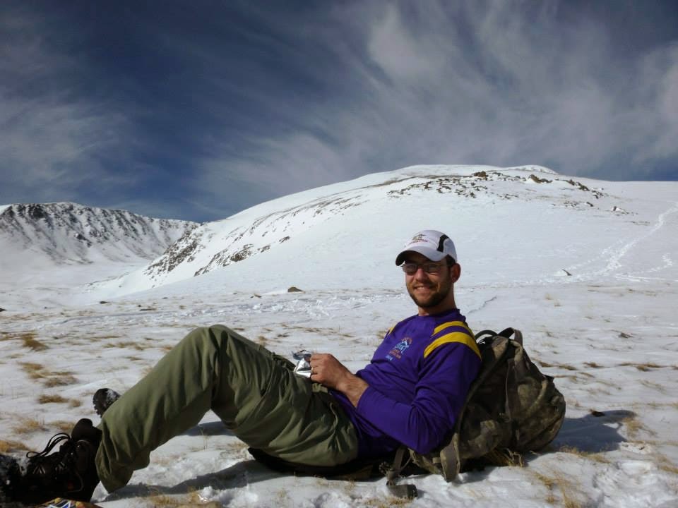
 This was my first winter ascent of a Colorado fourteener and it was an awesome trip.  I had been eyeing Mt Elbert for quite some time as it is on the list of the State Highpoints.  I have been collecting highpoints as a hobby since high school and ever since I moved to Colorado I have wanted to add the Colorado high point to my list.  Well, three years later and it was time to move out of Colorado and I still hadn't made the time to climb it.  I planned out the trip up the east ridge using  the South Mt Elbert trail and since it was winter we would need to use the trailhead at the bottom of the summer 4wd road.  I convinced a friend of mine to climb with me and thankfully he came along. I downloaded the .gpx files from 14ers.com and used my Garmin Foretrex 410 to navigate though most of the trail was pretty well defined.


We left Colorado Springs at about 5:00 and left the trailhead at 7:45.  The dashboard was reading 15 degrees when we stepped off so the snow was still packed well at from the trailhead all the way up the 4wd road.  Despite the temperatures we quickly heated up with hiking and dropped layers within the first 30 mins and climbed in long sleeve t-shirts and one other layer for the rest of the climb.

4wd Road leading to Trailhead


Elevation profile of the route...
Trailhead sign at top of 4wd road


 We continued over the small footbridge and uphill from there, the trail was pretty steep and slick but I put on my microspikes and had enough traction to make it up without too much trouble.  There had been quite a few people on the trail to pack down the snow so we didn't need snowshoes for a good portion of the climb.  The scenery was great as we plodded through the aspen grove and continued to climb.
Travis making his way through the Aspens
Footbridge
Eventually as we neared treeline the trees changed from aspens to pines and the snow got deeper.  I began to posthole quite a bit (up to my waist at one point) and we finally decided to put on the snowshoes which we wore for a while longer.   It was right about this time we passed a group of 5 from Texas who had traveled up for the weekend to climb Elbert.  They said they had stashed their snowshoes at the 4wd trailhead and were regretting it.  We continued on and didn't see them after that, they didn't summit that day, I hope they get a chance to get up there before they have to get back to Texas.

Travis at tree line
Snowshoes necessary above tree line
    We continued on snowshoes for a while longer and eventually made it to a small rocky outcropping  at 12,300' where we stopped to have an early lunch.  We were in no rush to the top so we took our time and after about 30 mins kept heading up.

Great spot for lunch right at about 12,300'


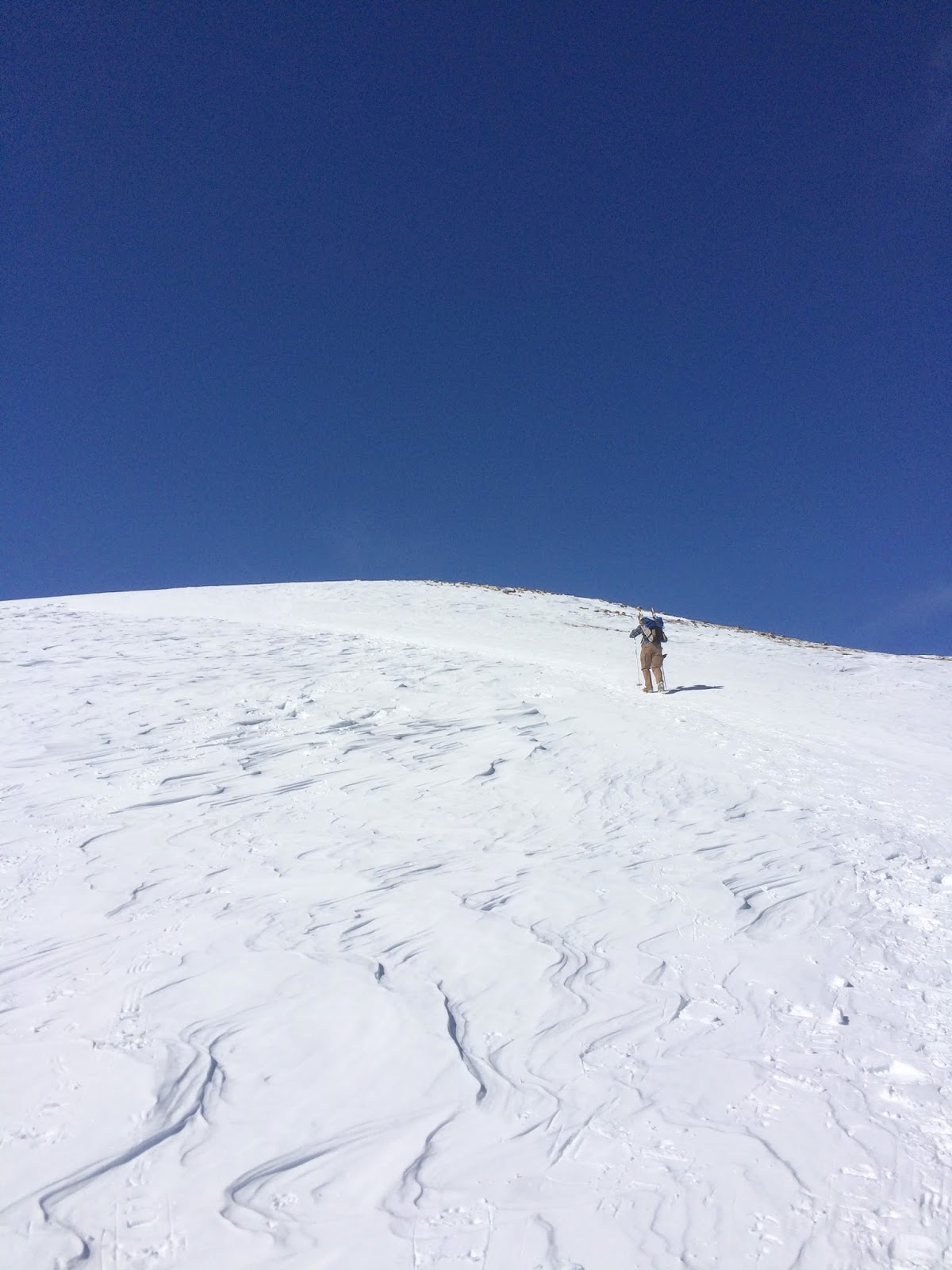
The snow was pretty stiff and windblown so we strapped the snowshoes back to our packs and kept climbing in the microspikes.  This served us well to the summit, the remainder of the climb alternated from stiff windblown snow to bare rock and we actually followed the summer trail which was still visible in sections to within about 1,000' of the summit.  At this point the well defined trail we were following from other climbers had branched out into many different approaches so we generally just kept heading "up" with minor course corrections looking at the waypoints on my Foretrex.

We actually spotted several groups of ptarmigans by nearly stepping on them, their camouflage is pretty impressive and their coos were an interesting way to break up the monotony of the climb up for a while.

Pretty cool little birds
The last few hundred feet of elevation consisted of  a thick snow cap and several false summits, by now the altitude had really started to catch up to me and it seemed like I needed to take a break every few steps.   As we were nearing the summit two other groups passed us on their way down but they were taking a slightly different track so we didn't talk much more than a few waves.  Finally we were in view of the summit and took the last few steps to the highest peak in Colorado.  We summited at 1:45 which gave us about 6 hours of climb time to the top. The views were spectacular and the feeling of completing this highpoint was incredible.  We stayed at the top long enough to snap a few pictures but clouds were starting to build so we didn't want to stay too long.

Summit pictures


  The descent was quick with nothing really to report except that the temperatures were starting to warm and thus the snow starting to melt.  At about 12,300 feet we stopped at the same spot we had lunch at on the way up and donned our snowshoes and needed them for the rest of the climb down.  As we got into treeline the snow really got soft and I was once again thankful for the snowshoes, the steeper sections were very slick and we took a few slips and falls but overall no major problems for the descent.  We made it back to the car just after 4:00 pm just in time to see the clouds really billowing over the summits.  The total trip took us 8 hours and 15 minutes with a distance of 11.4 miles and 5,409' of elevation gain. 

Below is a link to my Garmin adventure (built with garmin basecamp) with geotagged photos.  Enjoy!  Mt. Elbert Winter Ascent

Thursday, January 1, 2015

Pikes Peak Ascent and Triple Crown of Running 2014- Race Recap


I completed the Pikes Peak Ascent last year in 2014 and never got around to writing a race recap for it but I figured that a lot of people would be starting their train-up for the race this spring and might be interested.  It is a really incredible race, and one that is truly different from anything I have ever done before.  I usually stick to road races and have done my fare share of 5k's, 10k's, and half marathons but running up a mountain sounded crazy to me.  But I found out I would be leaving Colorado soon and that mountain just kept staring me in the face so I decided to sign up for it.  I also convinced my wife, Kim, to sign up as well.  She wasn't too excited to begin with but I think as the race got closer we both were pretty happy.  Kim had a qualifying time already but this race fills up REALLY quick so we missed the registration window for her to sign up with qualifications.  I was deployed to Afghanistan the year before and hadn't done much running previous to this attempt so all of my 1/2 Marathons or Marathons were out of tolerance for the qualifications.  Because of this we ended up registering through the Triple Crown of running series without qualifications which uses your Garden of the Gods 10 miler time as a qualification and then you need a completion (no time requirement) for the Summer Roundup Trail run.  I will say that I am glad we both did this option.  Even though the Ascent is cool on its own the whole series was really a well put together event.  If I was still going to be in Colorado I would definitely be signing up for the series again.  Now the qualifications are pretty strict so if you aren't sure you meet them make sure you check and double check before you shell out cash.  The race officials will check online results for races to ensure you can actually complete the race (so don't try to cheat the system).  Race qualifying details can be found Here, and Triple Crown of running info can be found Here. I can definitely say that this entire series wasn't easy but I learned a lot of good lessons about training and running by trying different types of races.

Garden of the Gods 10 Miler:
The first race of the series was the Garden of the Gods 10 Miler.  This race, if you look up the TCR option without qualifications, requires you to complete it in less than two hours.  Kim and I were pretty confident as we had been training pretty good all summer for the Chicago Marathon in the fall but on a whim decided to do a training run in the park.  It quickly became evident that this wasn't going to be a walk in the park.  The Garden of the Gods is EXTREMELY HILLY, now even though Kim and I were in pretty good shape we struggled with that first run in the park.  We eventually decided that we needed to train specifically for this race or we wouldn't make the cutoff time for the Ascent, which was  our primary goal.  This was a really important lesson for me.  I have never really trained on running the same course as a race before so starting to learn where I could push myself on hills and where I needed to take it easy were invaluable on race day.  I really came up with a race strategy for this one and it worked out great.  Kim and I started by working 5-7 mile runs through different segments of the park each weekend as our long run and then were really able to map out the hills that were going to be difficult.  It also helped that I trained by pushing the baby stroller so on race day I literally felt 30lbs lighter. 
Training Runs in Garden of the Gods
Training Run in Garden of the Gods


On race day we really felt prepared.  My plan was to try to keep 9 minute miles for the majority of the course and to slow it down on the two really big hills (at miles 2 and 5)  On those hills I would let myself drop to 9:30 miles and had my watch set to show lap pace, that way for each mile itself I wouldn't let myself lose too much time.  I ended up doing almost exactly that and completed the race at 1:31:34 almost a half hour under the required time.  I felt great and actually had some gas left in the tank, I think I could have gone a little less conservative and beat the 1:30:00 time. If you complete the 10 miler in under 1:30:00 you actually qualify for wave 1 on the ascent (which I will get into later).  Kim did great too, and despite giving birth only 5 months before she finished in about 1:50:18 or about 11:00 minute miles on a really difficult course.  The race support was great and I loved the high school water stops (the minions were my favorite) the end of the race also had free beer! and pizza which was definitely welcomed.  The only issue I had with the organization was that the handout of the medals and shirts took forever.  We had to wait in line almost 30 minutes to get ours.  Not something you want to do after running a race.  So that was that and we both were set to conquer the Ascent.  All we needed to do now was complete the Summer Roundup.

Summer Roundup Trail Run:
We didn't train specifically for the summer roundup like we did for the 10 miler.  In fact we really just went back to our Marathon training plan and assumed we would be able to finish.  This was nice as it was a low stress event that we could really just have fun on.  I took off from the start expecting to be able to keep an 8:30 or so pace for the 12k trail run.  This didn't work out quite well as the course was single track for a large portion of the way and passing was difficult. My first mile split was over 10 minutes and then really alternated between 8:15 or so when I could break out and 10:00 when I got stuck on single track behind slower runners.  Overall it was a really nice race and I didn't mind too much getting bogged down. It actually allowed me to enjoy the run a little more than constantly pushing the pace uphill.  I ended up finishing at 1:06:33 or just under a 9 min mile and Kim finished at 1:23:52.  That was it, we were now officially set to run in the Ascent!

Pikes Peak Ascent:
We woke up early on Ascent day and headed down to the starting area as we knew parking was going to be a nightmare.  Manitou springs is notorious for being difficult to park and on this day that was no exception so we got there early enough and grabbed our spot to stretch and get ready.  I wore my Camelbak Hawg and came prepared with a ton of GU's and a peanut butter sandwich.  I knew that on this race I was going to need good nutrition.  This was probably the biggest lesson I learned from the Ascent.  On most of my other long runs I have really run out of fuel, especially during the St. Louis Marathon so I wanted to be prepared here and it worked out well for me.  The build up to the race was really interesting and since we were in wave two we got to watch the start for wave one a few minutes before us.

Finally it was time for us to start.  Now I have heard from a lot of people and through reading race recaps that it behooves you to get out in front early because it slows pretty quick once on the mountain.  I took this to heart and tried to move up in the pack from the beginning as we moved along the streets of Manitou springs.  I may have been a little too conservative though because as he hit the trailhead the group came to a grinding halt and we spent most of the next four miles or so walking until the pack thinned a little. If I had to do it over again I would really push that first mile or two to get to the front of the pack, especially in wave two.  That was really the story for much of the race as well.  Passing becomes very difficult (if not impossible) so if you are behind from the get go you will be stuck with a much slower time throughout.  The race stayed pretty stop and go all the way to Barr camp where I had managed to pass enough people that the field was beginning to thin.  At that point I also began to pass some of the slower runners from wave one which really surprised me.  There were several aid stations set up along the route and I made a concerted effort along the way to make sure that I drank Gatorade and ate something at each one. The race was really well supported despite the difficult access to the trail and each aid station had tons of different snacks and water/Gatorade.  The one thing I knew I didn't want was to run out of fuel.  I had my Camelbak as well and drank all of that water too, I will say though if I was going to do more of these races I would invest in a running specific water source (maybe a vest) as the Camelbak worked but it bounced around a lot and got a little uncomfortable.   As the field thinned I got into a good rhythm of running for a half mile or so and then walking to catch my breath and then running again and I kept this up all the way to tree line.  Once I hit treeline, I don't know if it was a mental thing or the altitude actually getting to me but I felt it was much harder to breath and my run/walk cycle started to turn more into a walk/run cycle.  I continued to push up the hill though and was buoyed by the sound of the announcer at the top.  That was one thing that I really didn't expect, I still had miles and miles to go but I could hear him announcing others finishing and that made it seemed like the end was near.  Above tree line there is a long series of steep ascents and quick switchbacks which helped break up the monotony.  At this point in the race my goal was really just to not stop and take any breaks but continue forward progress at all costs.  This worked out pretty well too as I passed quite a few people who were sitting on the side of the trail.  With about two miles to go I started to get a bad cramp in my right calf but stopped to stretch a few times and was able to keep moving with my walk/run.

Finally the finish line was in sight and I pushed myself to run the last stretch.  My final time was 4:04:11 which I was pretty happy with.  They say on the website that your Ascent time is generally equal to your flatland Marathon time and my goal time for Chicago later that year was 4 hours so I think that was pretty accurate.  I do, however, think that if I had run just a minute and a half faster on the Garden 10 miler I could have gotten a much better time with a wave one start.  I lost a lot of time at the beginning when the field stopped on the trail.  Oh well, with my finish time on the Ascent this time I qualify for wave one next year!  Kim had a really tough race finishing in 5:26:06.  I think she may have had some sort of altitude sickness because by the time she got to the top her lips were turning blue...  needless to say we didn't spend a lot of time at the summit, we snapped a few obligatory pictures at the top and hopped on the next bus down the Manitou springs. 


Overall a really well put together race and an awesome series.  I would definitely recommend it to anyone looking for a challenge or for something to break up your training with something a little different.